

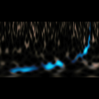
Mapping LIGO Detections on the Sky
Image credit: LIGO/Axel Mellinger
The approximate locations of the two gravitational-wave events detected so far by LIGO are shown on this sky map of the southern hemisphere. The colored lines represent different probabilities for where the signal originated: the outer purple line defines the region where the signal is predicted to have come from with a 90 percent confidence level; the inner yellow line defines the target region at a 10 percent confidence level.
- Related News
-
LIGO Does It Again: A Second Robust Binary Black Hole Coalescence Observed
News Release
- Related Images
-
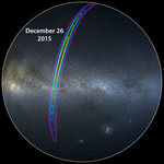
Mapping LIGO’s New Detection on the Sky
Collage Image
-
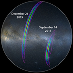
Mapping LIGO Detections on the Sky
Collage Image
-
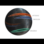
Mapping LIGO’s Detections During First Observing Run
Collage Image
-
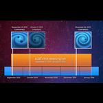
LIGO's First Observing Run
Chart Image
-
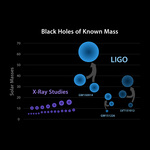
Black Holes with Known Masses
Chart Image
-
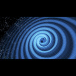
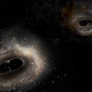
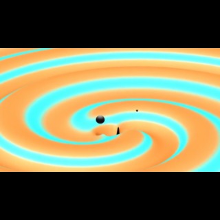
Spiral Dance of Black Holes
Artwork Image
Download Image
- JPG
About the Image
- Date
- June 15, 2016
- Location
- LIGO Lab
- ID
- ligo20160615b
- Type
- Collage
- Credit
- LIGO/Axel Mellinger


